

WhiteboxTools in GIS: Complete Guide to Geospatial Analysis

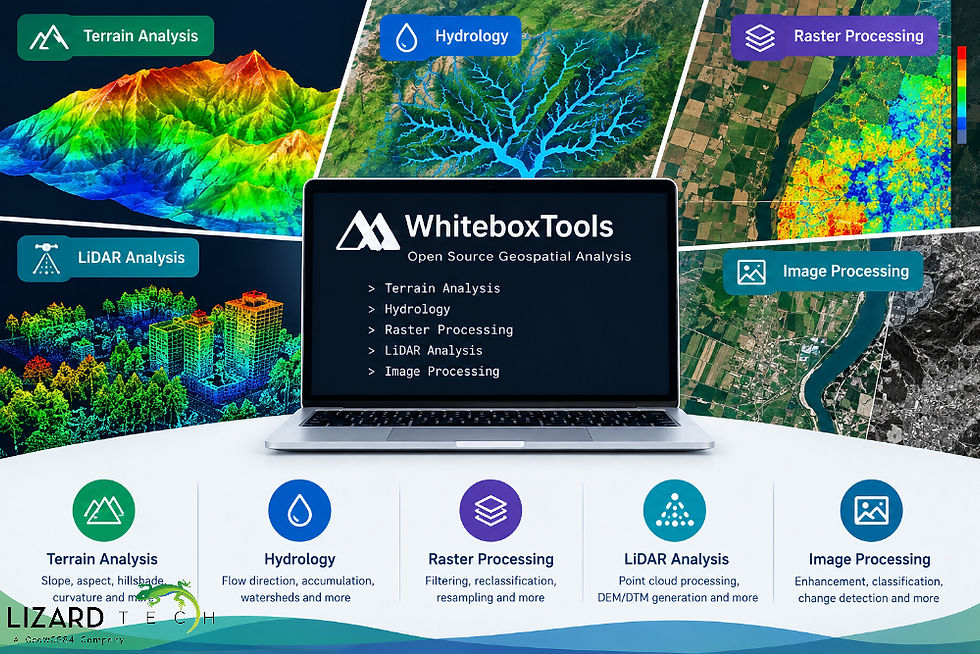
Processing of geospatial data is one of the processes that demand effective and powerful tools. WhiteboxTools is an open-source geospatial analysis software that is designed to allow efficient processing of geospatial data. The software offers a comprehensive collection of tools for terrain analysis, hydrology, raster processing, LiDAR analysis, and image processing.
For GIS analysts, remote sensing analysts, researchers, and developers, WhiteboxTools is capable of automating complex geospatial processing tasks. The software tools are highly applicable when analyzing and processing Digital Elevation Models (DEMs), Digital Terrain Models (DTMs), LiDAR point clouds, satellite images, and any other geospatial data.
What Is WhiteboxTools?
WhiteboxTools is an open-source geospatial data analysis library with several hundred tools to process and analyze geographic data. This software was developed as a component of the Whitebox Geospatial platform and is widely used in terrain modeling, hydrology analysis, GIS data processing, and LiDAR applications.
The main advantage of WhiteboxTools is its command-line interface, while traditional desktop GIS software usually implies the use of graphical interfaces. Thus, WhiteboxTools is helpful for automating geospatial processing, running batches, writing scripts, and connecting other GIS applications.
WhiteboxTools can process the following types of datasets:
DEM (digital elevation model)
DTM (digital terrain model)
LiDAR point clouds
Vector data
Hydrology data
Terrain derivatives
This software is beneficial because users do not have to manually perform every step of spatial analysis in a desktop GIS.
Why Use WhiteboxTools for GIS?
The typical tasks performed within GIS are often quite repetitive and computationally demanding. WhiteboxTools offers special algorithms that allow you to simplify such tasks and make them much faster.
The most significant advantages are the following:
Open-Source Geospatial Processing
As a free and open-source platform, it can be used by researchers, programmers, educators, and other organizations that require flexible geospatial software.
Extensive GIS Toolset
The platform includes tools for:
raster analysis,
terrain analysis,
hydrology,
LiDAR analysis,
image analysis,
vector processing,
geomorphometrics,
spatial statistics.
Automation
The command-line interface of the software can be used to automate certain processes. This is especially relevant when working with multiple DEMs, lidar TIFFs, or rasters.
High-Resolution Terrain Analysis
WhiteboxTools has a wide range of tools that are specially developed to carry out an analysis of DEMs and digital terrain models.
Terrain parameters can be obtained by using:
Slope
Aspect
Hillshade
Curvature
Flow Direction
Flow Accumulation
Wetness Indices
Topographic Position
Ruggedness
LiDAR Processing
Special features in WhiteboxTools allow users to analyze the data collected with the help of airborne laser scanners.
LiDAR Processing with WhiteboxTools
LiDAR data gives information regarding terrain and surface features in three dimensions.
LiDAR data may contain several million or billions of points, and hence, effective processing is necessary.
WhiteboxTools offers several LiDAR processing tools that include:
Point cloud filtering
Ground point classification
Canopy analysis
Digital elevation model creation
Point cloud metrics
Height normalization
Terrain analysis from LiDAR data
A typical LiDAR workflow may involve:
LiDAR point cloud → Classification → Extraction of ground points → Interpolation → DEM/DTM → Terrain analysis
Such a LiDAR processing workflow could be applied to tasks including:
Forestry
Flood mapping
Urban mapping
Topography surveying
Infrastructural planning
Environmental monitoring
WhiteboxTools for Raster Processing
Rasters are an important element of GIS and remote sensing. The WhiteboxTools library offers many raster processing functions that can be used for manipulation and analysis of spatial grids.
Some of the functions available are as follows:
Raster mathematics
Reclassification
Resampling
Filtering
Smoothing
Edge detection
Raster statistics
Neighborhood analysis
Surface analysis
A combination of these functions can create a workflow for raster processing.
For example, a satellite image or a digital elevation model can go through several stages of analysis without opening and exporting the dataset separately.
WhiteboxTools with Python
One of the key benefits of WhiteboxTools is its ability to support programmatic workflows.
Python is widely used in GIS automation because it allows analysts to process large datasets and repeat analytical procedures consistently.
A simplified example of using the WhiteboxTools Python interface may look like:
from whitebox.whitebox_tools import WhiteboxTools

wbt = WhiteboxTools()

wbt.set_working_dir("/path/to/data")

wbt. slope(
    dem="elevation.tif",
    output="slope.tif"
)
The example demonstrates a basic workflow for generating a slope raster from a DEM.
Python-based processing can be particularly useful when the same analysis needs to be performed across multiple geographic areas.
WhiteboxTools vs Traditional GIS Software
WhiteboxTools is not a substitute for all GIS programs; rather, it complements desktop and cloud-based geospatial software.
The typical functions provided by traditional GIS tools are:
Data management
Cartography
Visualization
Editing
Analysis
Mapping
WhiteboxTools puts a strong emphasis on geospatial algorithms and processing.
For example, an analyst could visualize and prepare the datasets using QGIS, conduct geospatial analysis using WhiteboxTools, automate the process through Python, and publish geospatial data through the web-based application.
WhiteboxTools and Modern GIS Workflows
WhiteboxTools software is compatible with contemporary geospatial technology stacks consisting of open-source GIS, Python, cloud computing, and spatial databases.
One such workflow would consist of:
Satellite/Aerial/LiDAR Data → Cloud Storage → WhiteboxTools Processing → Python Automation → Spatial Database → Web GIS Visualization
These kinds of workflows allow organizations to convert their raw geospatial data into a useful format for further analysis.
For example, DEMs may be automatically processed to derive slope, aspect, hillshade, and hydrology data, and then distributed via a web-based GIS platform.
WhiteboxTools is a comprehensive open-source software suite useful for GIS analysis as well as geospatial analysis in areas such as terrain modelling, DEM processing, hydrologic analysis, LiDAR analysis, and raster analysis.
The numerous algorithms in the software package make it useful for GIS experts, remote sensing experts, developers, and companies that deal with large amounts of geospatial data. When used together with the likes of Python, QGIS, LiDAR data, DEMs, satellite images, and cloud geospatial solutions, WhiteboxTools is useful for highly automated and replicable geospatial analysis processes.
With the size and complexity of geospatial data continually increasing, tools like WhiteboxTools present an effective solution for turning raw geographic data into usable analytical products in various GIS applications.
For more information or any questions regarding the LizardTech suite of products, please don't hesitate to contact us at:
Email: info@geowgs84.com
USA (HQ): (720) 702–4849
(A GeoWGS84 Corp Company)


Comments