

AutoCAD 2027 Now Supports MrSID With Its Plugin

MrSID Imagery can now be supported in AutoCAD 2027 using the MrSID Plugin for AutoCAD. This will enable CAD and GIS professionals to use highly compressed geospatial raster data directly in AutoCAD without having to go through complicated imagery conversions.

What is MrSID?
MrSID stands for Multiresolution Seamless Image Database. It is an image file format that enables efficient compression and viewing of large geospatial raster files. The format is known for its ability to reduce the file size significantly while still retaining good visual quality.
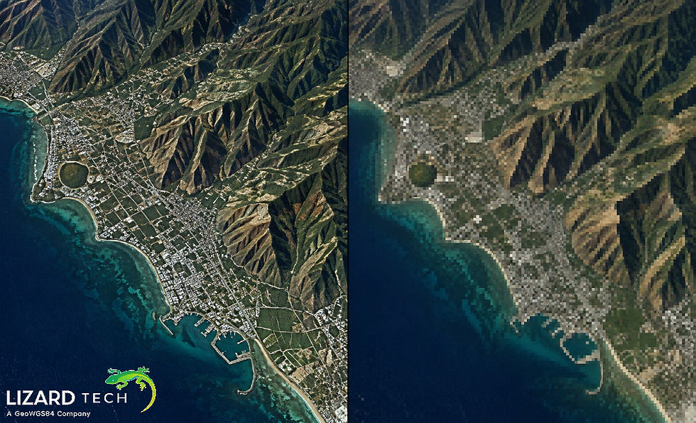
MrSID allows for multi-resolution images that can be easily zoomed and panned through large datasets. This makes the file format highly suitable for satellite images, aerial photographs, orthophotos, scanned maps, and other geospatial rasters.
MrSID Support in AutoCAD 2027
Through the use of the MrSID Plug-In for AutoCAD 2027, one is able to utilize MrSID imagery while working from his/her existing CAD software environment. Rather than treating satellite and aerial imagery as a distinct pre-processing step, this plug-in offers a way to integrate MrSID images with one's AutoCAD project.
Applications for such a feature include working with:
Orthophotography
Geospatial basemaps
Surveying/mapping data
Engineering projects
Site development
Environmental/land use analyses
It can therefore serve as a way of making accessible imagery and compressed imagery within the same application environment.
Why Use MrSID for Large Geospatial Images?
The storage and bandwidth needs for large geospatial images can be considerable. Uncompressed geospatial imagery may also increase the burden on the dataset, particularly where the projects involve very high-resolution images from aerial surveys or satellites.
MrSID solves this problem by utilizing compression technologies for images while preserving their appearance.
The following are some key features of MrSID:
High Compression
MrSID allows you to significantly decrease the file size of a raster relative to the size of an uncompressed image.
Multiresolution Accessibility
The MrSID format relies on multiresolution, which provides the ability to observe images in varying resolutions. A user can zoom in to particular regions without handling an entire raster of a particular image at all resolutions.
Visual Quality
It is designed to ensure high visual quality when decompressed and, therefore, is ideal for imagery that serves as a reference in terms of mapping, planning, and engineering.
Efficient Large-Image Handling
Working with large aerial and satellite images may not be easy in traditional formats, and MrSID is geared towards such large geospatial images.
How the AutoCAD and MrSID Workflow Helps
In many CAD applications, the imagery is used as a reference for the geographical locations. The engineering firm might need images taken from satellite or air to analyze the existing conditions prior to designing roads, utilities, buildings, or any other infrastructure.
A common workflow may include the following steps:
Satellite or aerial imagery → Compression via MrSID → Visualization via AutoCAD → CAD design and analysis
Using the plugin allows including MrSID imagery directly into the AutoCAD system and avoid maintaining an extra image viewer workflow.
This way helps teams to refer to imagery during the process of drawing and layout.
MrSID vs. Traditional Raster Workflows
One such advantage is that the imagery can be highly compressed yet useful for visualizations.
In a conventional approach, users need to change the format of huge datasets of raster images to a more usable format for their applications. This process of changing formats might consume more storage and involve other steps of processing.
A workflow with MrSID will help avoid such unnecessary steps of copying large image datasets.
This is particularly true in the case of those agencies that have huge amounts of aerial or satellite imagery in terabytes.
What the MrSID Plugin Means for AutoCAD Users
With the inclusion of support for MrSID files, CAD users now have an additional choice for dealing with geospatial images. Instead of segregating the two processes, users will be able to incorporate their geospatial raster image data within CAD processes.
If firms are already storing their MrSID files, the support in AutoCAD 2027 will allow them to use their stored imagery better.
This results in a more efficient way of incorporating CAD files with geospatial raster images.
The compatibility of AutoCAD 2027 with MrSID using its plugin is an effective means of handling compressed imagery in CAD systems. The characteristics of MrSID, such as multiresolution structure, efficient compression, and ability to handle large geospatial databases, make it a useful tool for businesses maintaining large amounts of imagery.
Engineers, surveyors, GIS experts, planners, and infrastructure teams will be able to easily handle geospatial reference imagery when using MrSID imagery within AutoCAD.
Download the MrSID Plugin for AutoCAD 2027
For more information or any questions regarding the LizardTech suite of products, please don't hesitate to contact us at:
Email: info@geowgs84.com
USA (HQ): (720) 702–4849
(A GeoWGS84 Corp Company)


Comments