

LiDAR Data Compression: LAS vs LAZ vs MrSID

LiDAR is a technology used for surveying, mapping, and various engineering and forestry applications that generates 3D point cloud data. But LiDAR datasets can get very big, since each point will have coordinates, elevation, intensity, classification, returns, and many other parameters.
Data compression for LiDAR reduces storage and increases speed for data transfer and processing. There are three formats commonly used in geospatial data processing: LAS, LAZ, and MrSID. Even though all of them provide effective data management for geospatial data, they differ in function and format of information storage.

What Is LiDAR Data?
LiDAR devices use laser pulse technology for measuring distances between a scanner and objects on or above the Earth's surface. LiDAR scanning allows collecting millions or even billions of points, creating a point cloud.
The usual attributes of a LiDAR point are the following:
X, Y, Z coordinates
GPS/GNSS timestamp
Intensity
Return number
Number of returns
Classification
Scan angle
RGB values
Custom fields
The resulting data set can be utilized to develop various geospatial products such as DEMs, DTMs, DSMs, contours, 3D models, etc.
Due to the large amount of data obtained in LiDAR surveys, choosing a proper file format plays an important role in the process of handling LiDAR data.
What Is LAS?
LAS (LASer) is a standard binary file format commonly used for transferring and storing LiDAR point cloud data. LAS was created to have a unified format for airborne LiDAR data and has gained wide adoption within GIS, remote sensing, surveying, and point cloud software.
LAS contains the LiDAR data points themselves together with all related attributes. The number and type of attributes depend on the particular LAS version and point data record format but can include coordinates, intensity, classification, returns, colors, waveforms, and other metadata.
Advantages of LAS
Wide compatibility of LAS with LiDAR and GIS software
Ability to preserve detailed attributes of each data point
Format suited for data exchange
Easy to process and interpret
Can be used as an uncompressed or minimally compressed point cloud data format
Drawback of LAS
Large files. Due to the high volume of data collected during LiDAR surveys, LAS files may be very large. This increases storage needs and slows down file transfers.
LAZ becomes handy in such situations.
What Is LAZ?
LAZ is a compressed variant of the LAS format that makes use of compression techniques tailored for LiDAR point cloud data while keeping the necessary information needed to recover the original LAS data.
As opposed to handling the point cloud as just any other generic binary file, LAZ utilizes features of LiDAR data to compress the data, thus reducing redundancy.
LAZ Benefits
Much smaller compared to its LAS counterparts
Compressed in a lossless manner
Keeps LiDAR point data intact
Fast transfer and cloud storage of data
Supported in most LiDAR software packages
Suitable for distributing large LiDAR point-cloud data sets
LAZ is especially useful for organizations that are trying to transmit LiDAR data across different systems.
LAS vs. LAZ
It comes down to one main thing:
LAS is a format that contains uncompressed point clouds, whereas LAZ is the lossless compression of LAS.
If the same LiDAR data is saved both as LAS and LAZ files, the LAZ format takes up much less storage space in comparison with the former.
What Is MrSID?
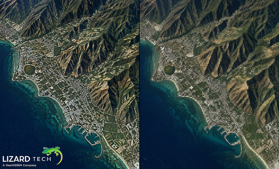
MrSID (Multiresolution Seamless Image Database) is a technology related to the compression of geospatial imagery, which was created by LizardTech. In contrast with LAS and LAZ formats, MrSID is a format used mainly for raster and imagery files and not for LiDAR point clouds.
MrSID utilizes sophisticated compression technology and multiresolution features to make geospatial imagery datasets easy to handle and visualize.
It may be used for:
Orthophotos
Map scans
Large raster datasets
Geospatial imagery mosaics
MrSID cannot be considered a direct substitute for LAZ in storing LiDAR point clouds.
LAS vs. LAZ vs. MrSID
Feature | LAS | LAZ | MrSID |
Primary use | LiDAR point clouds | Compressed LiDAR point clouds | Geospatial imagery |
Data type | Vector/point cloud | Vector/point cloud | Raster imagery |
Compression | Generally uncompressed | Lossless LiDAR compression | Advanced image compression |
Point attributes | Yes | Yes | Not designed for raw LiDAR points |
Multiresolution imagery | No | No | Yes |
Typical use | LiDAR exchange and processing | LiDAR storage and distribution | Large imagery storage and visualization |
Best suited for | Working with original point-cloud data | Reducing LiDAR storage and transfer size | Managing large raster imagery |
It is imperative to highlight that LAS and LAZ are part of the LiDAR point cloud processing workflow, while MrSID is essentially an imagery compression technology.
When Should You Use LAS?
LAS can be considered a suitable option for:
Need for good compatibility with LiDAR software.
Exchanging point clouds between applications.
Requirement of simple representation of LiDAR data.
Storage size is not of major significance.
Using particular software that supports the LAS file format.
LAS files can be used as an intermediate format while processing and exchanging LiDAR files.
When Should You Use LAZ?
LAZ files can be considered a good choice for:
Very large LiDAR files.
Efficient storage.
Transferring point clouds through a network.
Lossless compression.
Development of LiDAR workflows using cloud technology.
Efficient distribution of LiDAR data.
LAZ files can be considered a convenient choice for the reduction of storage in many current LiDAR workflows.
When Should You Use MrSID?
MrSID is more appropriate when there is large raster imagery being used instead of LiDAR point cloud data.
For example, where an institution deals with aerial images, orthoimages, satellite imagery, or large rasters, they can employ MrSID as a way of minimizing storage space while enabling image processing at the same time.
In this case, the LiDAR project can use LAZ for the point cloud data and MrSID for the raster data.
Key Differences Between LAS, LAZ, and MrSID
The formats mentioned above differ in their purposes for geospatial data management.
In the case of working with raw LiDAR point cloud, the choice will be mostly between LAS and LAZ. MrSID comes into play when the process involves working with large raster images.
LiDAR data compression has gained prominence due to the increase in the size of surveys and the transition to cloud-based storage, remote processing, and large-scale data distribution.
The LAS format gives users a structure that allows storing LiDAR point clouds, whereas LAZ compresses the data without any loss of information, making it easier to handle. In contrast, MrSID aims at managing large-scale geospatial imagery and rasters efficiently.
This information about the differences allows GIS professionals, surveyors, remote sensing experts, and data managers to choose a suitable format based on the nature of the data, processing, storage, and distribution needs.
For more information or any questions regarding the LizardTech suite of products, please don't hesitate to contact us at:
Email: info@geowgs84.com
USA (HQ): (720) 702–4849
(A GeoWGS84 Corp Company)


Comments