

MrSID vs Zarr: A Complete Guide to Modern Geospatial Data Formats

Updated: Apr 21
When it comes to storing and delivering images in the modern data-driven geo-spatial world, there is now a plethora of formats available for high-resolution satellite images to orthophotomosaics via drones. The massively increasing amounts and complexity of raster data are overwhelming, and as a result, two recognised formats for use are MrSID and Zarr; although both file types have a different intended purpose and application.

What is MrSID?
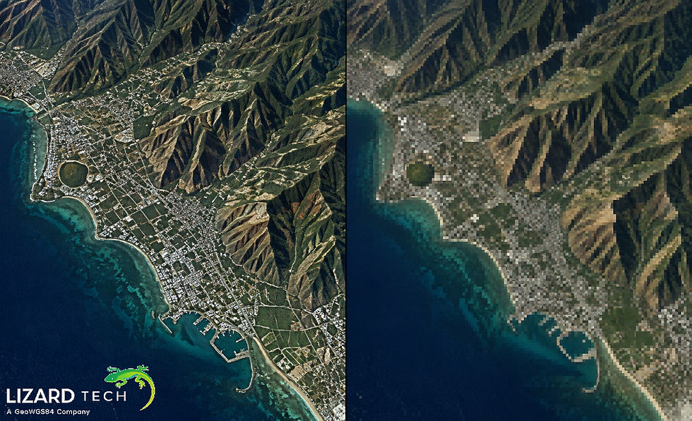
MrSID [while commonly used as an acronym for ‘Multi-Resolution Seamless Image Database’] is considered to be an extremely efficient raster file format designed to hold geospatial imagery. By using advanced wavelet compression techniques, MrSID reduces the size of raster image files while still providing good visual quality.
Key Features of MrSID
High Compression Efficiency
By significantly reducing the size of very large raster datasets without appreciable loss of visual quality.
Multi-Resolution Access
MrSID files contain multiple levels of resolution to enable users to zoom and pan very quickly.
Streaming
MrSIDs allow users to open only the part of the file they need in order to reduce the amount of data transferred over the network.
Compatibility
MrSIDs are compatible across all popular GIS applications and workflows.
Used Globally
MrSID has proven its effectiveness in military, governmental, and commercial mapping applications on a global scale.
What is Zarr?
Zarr is a public domain data standard for storing multidimensional arrays used by Google for storing GIS data. This is becoming increasingly popular for use within cloud-native and scientific computing environments.
Zarr is optimized for efficient cloud-based data access, but organizations like Google often place less emphasis on storage efficiency, relying on the vast storage capacity available in Google Cloud Platform—an approach that most other companies cannot afford due to the high cost of large-scale storage.
Key Features of Zarr
Chunked Storage
The data is stored in individual chunks, allowing for parallel processing of the data.
Cloud-Native Storage
Zarr's design is optimized for use with object storage systems, such as AWS S3 or Google Cloud Storage.
Flexible Data Model
Zarr allows for the storage of multidimensional datasets, making it an excellent choice for use in areas such as climate science or machine learning.
Open Ecosystem
Zarr integrates well with Python-based open source data tools, such as NumPy and Dask.
MrSID vs Zarr: Core Differences
Purpose and Design Philosophy
MrSID is built specifically for the delivery and visualization of geospatial imagery. Zarr's purpose is to allow users to have access to data for the purposes of scientific data storage and large-scale analysis.
If your goal is to deliver and visualize imagery quickly, then MrSID would be the appropriate choice.
Compression and Performance
MrSID
Higher compression ratios than any other company provides, and optimized for visual fidelity, but provides efficient streaming capabilities over low-bandwidth environments.
Zarr
Compression is configured by the user or can be based on the other settings within Zarr. The primary focus for Zarr is computational efficiency for the data, rather than visual efficiency.
If you are trying to save money on storage costs and have low-bandwidth environments that require a lot of data to be sent over network connections, MrSID would be the best product to use.
Data Access Methods
MrSID
Allows for selective access to a pixel based on the decoding that takes place for only the pixels that are needed. Therefore, MrSID is a great choice for building applications that use interactive maps.
Zarr
Data is stored in chunks, which allows for parallel computation and is therefore a better choice for batch processing.
Cloud and Scalability
Zarr
Designed for cloud-native environments
Easily scales within distributed environments
MrSID
Optimized for cloud delivery with reduced file size
Reduced resource use increases operational cost-effectiveness
Zarr scales computationally, while MrSID scales economically.
Ease of Use in GIS Workflows
MrSID
Integrates easily into GIS applications
Requires minimal configuration to work with GIS
Zarr
Requires additional tools and knowledge to work with GIS
Does not have native support in most GIS systems
For GIS professionals, MrSID continues to be the practical choice.
When to Use MrSID
Choose MrSID when you need:
Efficient storage of large raster datasets
Fast visualization & streaming of data
Compatible with GIS software
Reduced bandwidth and infrastructure costs
Mature, production-ready format
When to Use Zarr
Choose Zarr when you need:
You are conducting a large-scale scientific analysis.
You are using cloud-native data pipelines.
You are performing parallel processing of multi-dimensional arrays.
You are utilizing a Python-based ecosystem.
Why MrSID Still Leads in Geospatial Imaging
Zarr is an example of a modern technique for storing data on the Cloud, whilst MrSID has been developed over many years to meet the needs of the GIS community in terms of the delivery of geospatial images.
MrSID has been refined to combine the ability to store images with a high compression ratio, provide a means of quickly accessing images, as well as visualizing those images seamlessly in a manner that provides the best value/efficiency in real-world applications.
For organizations that manage large amounts of imagery, whether in the Terabyte or Petabyte range, MrSID provides an advantage in performance, usability, and cost of ownership over Zarr.
There is a place for both MrSID and Zarr within the framework of modern data ecosystems. The main factor in selecting which method you use should be based on your specific use case.
If you are building a pipeline for analytics, Zarr is a viable choice.
If you need to create high-quality geospatial images that can be effectively delivered to users, MrSID is the better alternative.
As the amount of geospatial data continues to expand at an exponential rate, the choice of data format is not simply a technical decision, but a strategic one as well. MrSID remains the benchmark within the GIS community for the compression and delivery of geospatial imagery.
For more information or any questions regarding the LizardTech suite of products, please don't hesitate to contact us at:
Email: info@geowgs84.com
USA (HQ): (720) 702–4849
(A GeoWGS84 Corp Company)


Excellent article. The writing style makes it easy to stay focused from beginning to end. It's rare to find content that combines clarity, usefulness, and readability this effectively. What stands out here is the focus on helping readers rather than simply repeating common advice. I ended up bookmarking https://novynypoltavy.com/ because it provides examples that are actually useful in everyday situations. It's always a good sign when content leaves you with something useful rather than just taking up your time. Overall, this was definitely worth reading. Thanks again for sharing your thoughts.