

Automating MrSID Image Compression Workflows With Python

Management of geospatial raster datasets is a key challenge in GIS and remote sensing analysis. Raster images in high resolution can take up much space and be difficult to process. In addition, large raster datasets may lead to increased data transfer times and performance issues with large-scale geospatial systems.
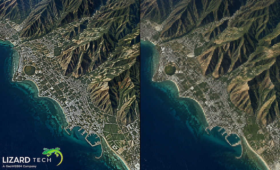
MrSID (Multiresolution Seamless Image Database) is a compressed image format based on the wavelet method. It reduces the size of raster images but preserves their visual characteristics and allows efficient access to raster images. This format is used for the storage of large satellite imagery, aerial imagery, orthophotos, etc.
Automation of the MrSID image compression process with Python can allow the GIS professional to automate time-consuming routine tasks, work with large collections of raster images, and include compression in the existing geospatial data pipeline.
Geospatial Python libraries and command-line utilities can be used for image preprocessing, format conversion, metadata parsing, and other tasks. One of the packages that can be used is gdal-sid from PyPI. It is connected to the topic of integrating GDAL and MrSID-related processes.

Understanding MrSID Compression in Geospatial Workflows
MrSID compression technology has been developed to process large amounts of geospatial raster data using wavelets. Unlike regular image formats, this format enables multiresolution capability, which means that applications can get access to image data with various resolutions without loading the whole raster dataset.
Among other features of the format are:
High compression performance: The reduced size of large raster datasets is provided.
Multiresolution capability: Facilitates quicker visualization with various zooms.
Image selection: Facilitates quick selection of images from the whole raster dataset.
Geospatial compatibility: The format maintains geospatial metadata for GIS applications.
Large datasets processing: Helps companies to share large satellite and aerial imagery collections.
Automated processing of repetitive actions within large numbers of rasters helps organizations to save time and avoid errors.
Python Tools for Automating MrSID Workflows
There are various utilities in Python for automating geospatial image processing pipelines.
Tool | Primary purpose |
GDAL | Raster reading, conversion, metadata extraction, and processing |
Rasterio | Python-based raster data access and analysis |
OS | File and directory management |
Subprocess | Executing external geospatial utilities |
Glob | Finding raster files using filename patterns |
gdal-sid | GDAL MrSID plugin distributed as a Python wheel |
Introducing the gdal-sid Python Package
gdal-sid is specifically useful in cases when you need to integrate MrSID support into your Python-based GDAL workflow.
This package includes the GDAL MrSID plugin in the form of a Python wheel that allows easy installation of the driver on supported Windows operating systems.
From the official PyPI documentation, we know that there is compatibility between the version of this package and the version of the respective minor version of GDAL. For instance, gdal-sid==3.6.4 is compatible with GDAL 3.6.x. The released version 3.11.3 contains Windows 64-bit and 32-bit wheels.
Note: gdal-sid allows integrating the driver into GDAL workflow. It is not meant to be used as an independent Python compression encoder.
Installing GDAL and gdal-sid
Before creating an automated workflow, install compatible versions of GDAL and the MrSID plugin.
First, install GDAL:
pip install GDALNext, install the corresponding gdal-sid version. For example, if using GDAL 3.11.x:
pip install gdal-sid==3.11.3The package documentation specifies Windows wheels and compatibility requirements. Therefore, verify the operating system, Python environment, GDAL version, and wheel availability before installation.
You can check the installed GDAL version using:
from osgeo import gdal
print("GDAL Version:", gdal.VersionInfo())
Verify MrSID Driver Availability
After installation, check whether GDAL recognizes the MrSID driver:
from osgeo import gdal
driver = gdal.GetDriverByName("MrSID")
if driver:
print("MrSID driver is available.")
print("Driver name:", driver.ShortName)
print("Driver description:", driver.LongName)
else:
print("MrSID driver is not available.")
If the driver is unavailable, check the GDAL plugin directory and the GDAL_DRIVER_PATH environment variable. The package documentation also identifies missing Microsoft Visual C++ redistributables as a possible cause of DLL-loading errors on Windows.
Automating MrSID File Inspection With Python
Before processing large raster collections, it is useful to identify existing MrSID files, inspect their dimensions, and extract their spatial metadata.
The following Python script scans a directory, identifies .sid files, and collects basic raster information using GDAL.
import os
from osgeo import gdal
input_folder = r"D:\GIS_Data\MrSID"
for filename in os.listdir(input_folder):
if filename.lower().endswith(".sid"):
file_path = os.path.join(input_folder, filename)
dataset = gdal.Open(file_path)
if dataset:
print("File:", filename)
print("Width:", dataset.RasterXSize)
print("Height:", dataset.RasterYSize)
print("Bands:", dataset.RasterCount)
print("Projection:", dataset.GetProjection())
dataset = None
else:
print("Unable to open:", filename)
This approach helps identify readable MrSID datasets before running more complex processing operations.
For large projects, the same process can be extended to generate CSV reports containing filenames, dimensions, coordinate reference systems, and other raster properties.
Building a Batch Processing Workflow
A batch-processing workflow can automate repetitive raster management tasks across multiple directories.
For example, GIS teams may need to:
Locate all MrSID files in a directory.
Check whether each file can be opened.
Extract raster dimensions and coordinate information.
Record processing results.
Identify files that require additional processing.
The following example automates file discovery and validation.
import os
from osgeo import gdal
input_folder = r"D:\GIS_Data\MrSID"
valid_files = []
failed_files = []
for root, directories, files in os.walk(input_folder):
for filename in files:
if filename.lower().endswith(".sid"):
file_path = os.path.join(root, filename)
dataset = gdal.Open(file_path)
if dataset is not None:
valid_files.append(file_path)
print("Validated:", filename)
dataset = None
else:
failed_files.append(file_path)
print("Failed:", filename)
print("\nProcessing Summary")
print("Valid MrSID files:", len(valid_files))
print("Failed files:", len(failed_files))
This script provides a basic validation framework that can be integrated into larger geospatial processing systems.
Using GDAL for Raster Conversion and Compression Preparation
GDAL provides several utilities for raster conversion, reprojection, and compression preparation. These operations are useful when preparing raster datasets for a MrSID-enabled workflow.
For example, gdal_translate can convert supported raster datasets into GeoTIFF format.
from osgeo import gdal
input_file = r"D:\GIS_Data\satellite_image.tif"
output_file = r"D:\GIS_Data\processed_image.tif"
gdal.Translate(
output_file,
input_file,
creationOptions=[
"COMPRESS=DEFLATE",
"TILED=YES",
"BIGTIFF=IF_SAFER"
]
)
print("Raster preprocessing completed.")
This example creates a compressed GeoTIFF, not a MrSID file. It can serve as a preprocessing stage before MrSID encoding through a separately configured, licensed encoding solution.
Best Practices for Automating MrSID Workflows
In automating the process of MrSID processing pipelines, consider the following suggestions:
Check compatibility with GDAL: Always use a gdal-sid library that is compatible with your GDAL library.
Validate datasets: Raster dimensions, projections, number of bands, and access to file should be verified before the processing step.
Batch process: Batch process large amounts of data instead of manually processing each file separately.
Log processing errors: Log all error messages for processes that fail.
Check spatial information: Verify the coordinate reference system, geotransforms, and other spatial information.
Validate compression: Quality of images and size of the dataset should be validated before using them.
Check for encoding capabilities: Make sure that you have the MrSID encoder software.
Validate output: Re-validate the output files after processing them before deploying them.
The process of automating image compression using Python is one way of streamlining the processes involved in geospatial data management, especially in dealing with extensive satellite images, aerial photographs, and other raster files.
GDAL, Rasterio, and various utilities form the basis on which Python can automate the processes of inspecting, preprocessing, validating, and other batch processes of rasters. The gdal-sid utility provides a critical step through the availability of the GDAL MrSID plugin in Python wheel format in a supported Windows environment.
It should be noted that there is a need to differentiate between support for the MrSID driver and ability of compressing image into the format. Complete compression workflow requires encoding tools and relevant licensing.
With the help of Python and GDAL in combination with the MrSID tool, GIS professionals can develop efficient workflows for geospatial imagery management and processing.
For more information or any questions regarding the LizardTech suite of products, please don't hesitate to contact us at:
Email: info@geowgs84.com
USA (HQ): (720) 702–4849
(A GeoWGS84 Corp Company)


Comments